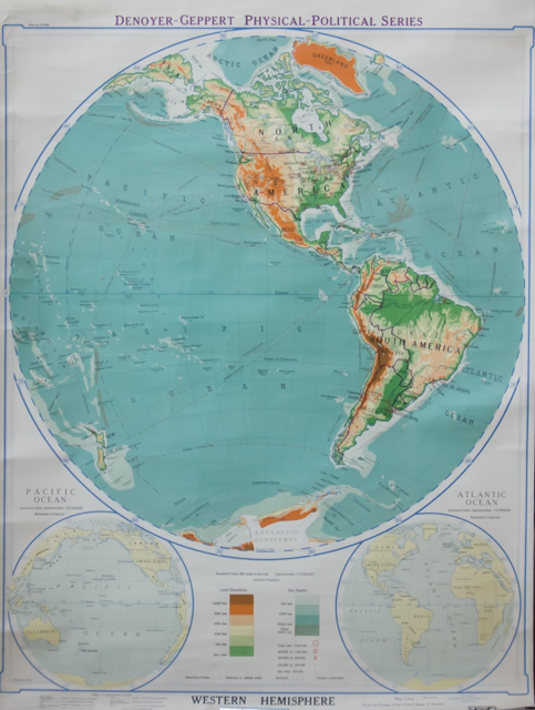
Western Hemisphere : Denoyer Geppert Physical - Political Series : map J 8 rp "from the people of United State of America"
Copyright Denoyer - Geppert Co.
Edition 1944 / Made in U.S.A.
Equatorial scale 300 miles of the inch, approximately 1:19.000.000 ; Globular Projection .--(80º Latitud Norte a 80º Latitud Sur / 160º Longitud Oeste a 20º Longitud Este).
Chicago : Board of Geographic Editors, L. Philip Denoyer, Managing editor, 1944.
1 mapa : papel, color ; 108 x 137 cm.
Recomendable para estudios de geografía física, proyecciones. Se observa relieve, división política, ríos, lagos, montes (cotas de altura).
Contenido
- Con referencias sobre elevaciones de tierra, profundidades marinas, ciudades, densidad de población, ferrocarriles, rutas navieras (distancias en millas terrestres)
- Incluye mapas: Pacific Ocean; Atlantic Ocean. Equatorial scale, approximately 1:57.000.000, Mollweide's Projection.

