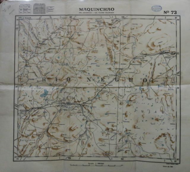
Maquinchao : Ing. Jacobacci y Col. Sierra Colorada : Nº 73
Instituto Geográfico Militar.
Edición año 1928.
Escala 1:500.000 ; Proyección policónica, Meridiano Central 64º Oeste de Greenwich . -- (40º a 42º Latitud Sur / 67º a 70º Longitud Oeste).
Buenos Aires : [Argentina] Instituto Geográfico Militar, 1928.
1 carta topográfica : papel sobre tela ; 53 x 48 cm.
Hoja nº 73
Se observan curvas de nivel, cursos de agua, divisiones políticas de los partidos, caminos, parajes y estancias.
Recomendable para estudios topográficos en la Meseta de Colitoro, Laguna Carri Laufquen y Sierra Colorada en la zona centro de Río Negro.
Contenido
- Se presentan dibujos de las hojas adyacentes y de la división política, y clasificación de los documentos según tipo de levantamiento.

